Along the Route 66
There's lights behind us and Mathias is forced to stop. "Police. Drivers license and car documents," demands the tall, strict officer with a raised voice, who suddenly appears next to our window. We don't know exactly what we did wrong, but we will be informed immediately. "Didn't you see the 30 miles sign?" - Uh no - "There's a race going on and people get killed, if you speed like that". We drove 40 as allowed on the last board we saw. But we already noticed many cyclists. Well, maybe we overlooked a temporary 30s sign. Mathias apologizes in all form. "You are not from here, so you don't know the area", it continues from the sheriff while he examines our papers. His facial features slowly relax and he finally lets us drive on with a smile on his face, as Mathias high and holy promises to take better care of us from now on.
A little later we arrive at the Puye Cliff Dwellings. Here we find the ruins of a village that was inhabited between 900 and 1600 A.D. by about 1500 Pueblo Indians. It is said to be the best preserved Pueblo after Mesa Verde. The descendants of the former Indians, members of today's Santa Clara tribe offer guided tours through the archaeological site. We take part in such a tour and learn a lot about life here.
The special thing about these former dwellings is that they were built on two floors, so to speak. At the top of Table Mountain were the summer houses and a few metres lower along the cliff of the mountain were the winter residences carved into the stone. In this way one could better protect oneself from the cold and warm up in the warming sun that shone on the cliffs. Today, only the walls of the former shelters can be seen. The rooms were built very low, so that one could move today only crawling. 1500 years ago people were much smaller, but even at that time the rooms were only used for sleeping. Life was mainly outside. In addition, one entered the rooms via a small hole in the ceiling. This was a form of defensive tactics against potential enemies.
As a highlight of the tour we were finally allowed to descend into a so-called "Kiva". These are circular underground meeting and ceremonial rooms of the Pueblo cultures. Wherever you step on the terrain, you will find fragments of pots and bowls in various colours. When the settled people had to move on due to a drought, they left all their pots out of respect for Mother Nature and gave her back what they had taken. The different colours of the pots had different meanings. Red crockery was for everyday use, black pots for cooking and grey for festivities.


After the very interesting guided tour we continue in the direction of Albuquerque. In Los Alamos we are a bit irritated when we suddenly have to drive to a barrier and show our passports. We are informed that we would now drive through a military exclusion zone and are instructed to drive through in one piece and it is strictly forbidden to take photos. Only later do we learn that the National Laboratory, the research centre for nuclear energy, is located here. The Manhattan Project was carried out here from 1942. In other words, the atomic bomb was developed and built here under the strictest secrecy. What happens today behind the concrete walls that we can see through the high-security fence we drive along, we'd rather not know.
Once again, a shower is urgently needed and washing clothes would not be bad either. We stay at the KOA Campground in Albuquerque. KOA is a campground chain, which is represented in most bigger places and in the proximity of objects of interest with a place. Although these campsites are not cheap, they are always beautifully designed, clean and have all the infrastructure one needs from time to time as nomads. To our joy, the place in Albuquerque even has a Jacuzzi, which we of course actively use. Since we still want to visit so many places before we get a visit from Switzerland at the beginning of December, we only stay one day in the city. But we don't leave it without visiting the "Twisters", the restaurant that served as the location for the scenes at Pollos Hermanos for the Breaking Bad series.


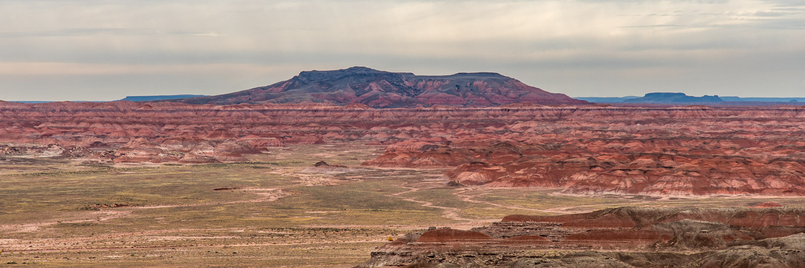
On the I-40 we drive west again. This highway served as a replacement for the former Route 66, but runs parallel and only a few meters away from the original. The legendary highway, which was one of the first to open up the west of the country and lead from Chicago to Los Angeles, also ran through a national park, the Petrified Forest National Park. Today, however, only old telephone poles along Route 66 in the area bear witness to this.
But the Petrified Forest has been declared a national park for another reason. As the name suggests, the park is home to petrified wood. Here you will find the largest collection of petrified tree trunks in the world. About 200 million years ago (Triassic) dinosaur-like reptiles lived in the area of today's National Park and there were huge forests. Overthrown trees were buried in mud and silt, slowing down the natural decay of the wood due to lack of oxygen. Groundwater containing silicic acid then seeped into the tree trunks. Quartz was deposited in the hollows of the trunks and gradually replaced the cell tissue, so that the structure of the wood remained visible in the stone. Later, tectonic movements raised the land masses in which the petrified trees were buried, creating the landscape we can admire today. However, most tree trunks broke due to tensions caused by tectonics.


